IN2000 — GeoScore Android App
Team Android app for climate and natural hazard risk assessment of Norwegian locations. Combines map search, weather data, flood/landslide risk scoring, and AI-generated reports. Nominated among the 10 best projects in the course.
IN2000 – Software Engineering with Project Work at UiO. Built in a team of 6 over one semester. GeoScore was nominated among the 10 best projects in the course cohort.
What the app does
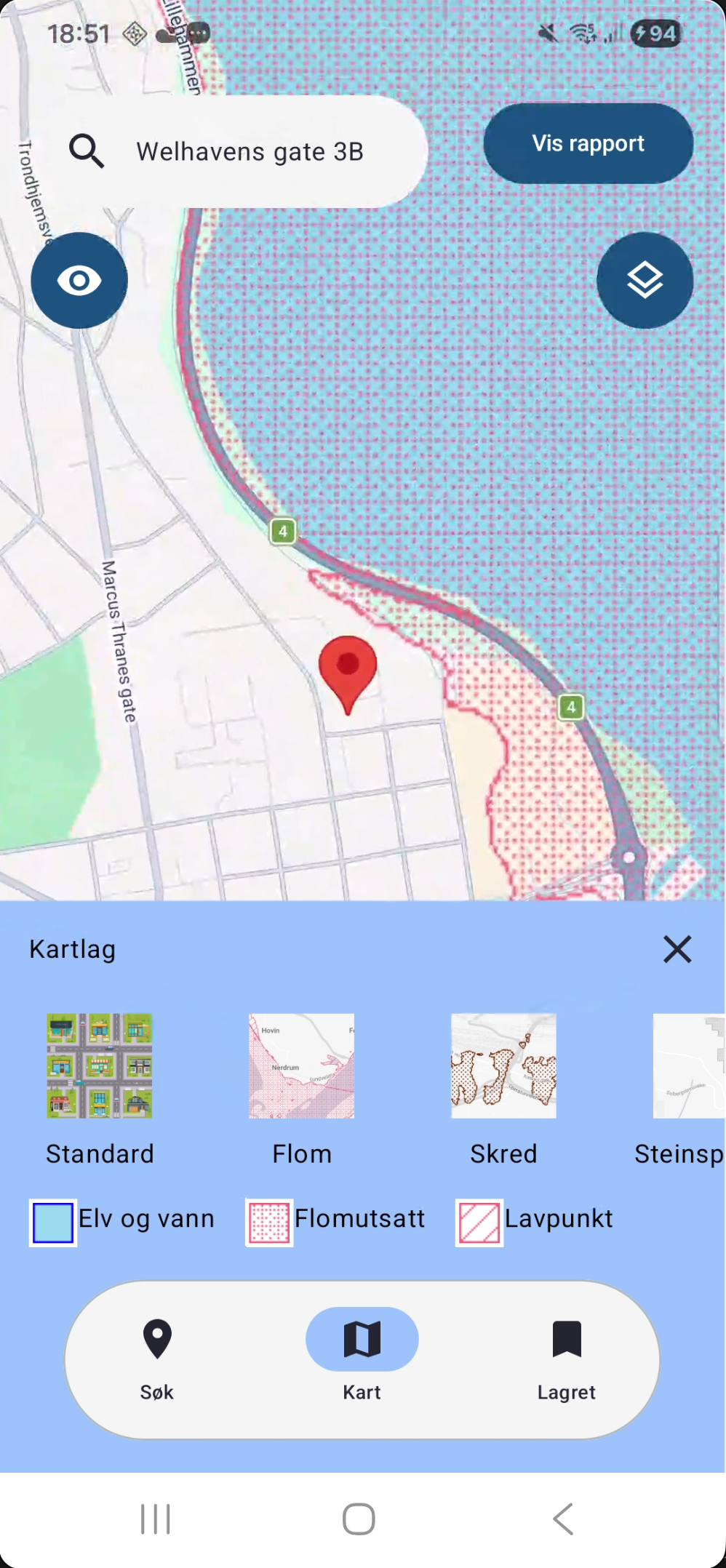
GeoScore lets users search for any Norwegian address or location on an interactive map and receive a combined risk assessment for:
- Wind exposure (historical data from Frost/MET)
- Precipitation intensity
- Flood risk (NVE flood zone data)
- Landslide risk (NVE susceptibility data)
The app synthesises these into a single score and generates an AI-powered written report explaining the risk profile of the location in plain language.
Architecture
The app follows MVVM (Model-View-ViewModel) with clean separation between data, business logic, and UI layers.
UI (Jetpack Compose)
      ↓
ViewModel (state + logic)
      ↓
Repository (data coordination)
   ↙         ↘
Remote API   Local cache (Room)
Dependency injection with Hilt — all repositories and ViewModels are injected, making the architecture testable and avoiding global state.
Data sources integrated
- Frost API (MET Norway) — historical climate data: temperature, wind, precipitation per location
- NVE flood data — zone classifications for Norwegian properties
- NVE landslide data — susceptibility scoring
- Google Maps Compose — interactive map with custom markers and location search
AI integration (OpenAI API)
After the scoring logic runs, the app sends the risk data to the OpenAI API and receives a natural-language summary. The report explains the risk factors in plain language and suggests practical implications (e.g., “high wind exposure — consider this when planning outdoor structures”).
Local caching with Room
Previously fetched risk assessments are cached in Room (SQLite). This means:
- The app works offline for previously searched locations
- Repeated queries for the same location return instantly
- The cache can be selectively invalidated when data updates
Navigation
Screen navigation is handled through Navigation 3 (Jetpack Navigation Compose). Each screen is a composable destination with its own ViewModel scope.
Team & process
Team of 6. We used GitHub for version control with feature branches and pull requests. Responsibilities were divided across data layer, UI, scoring logic, and AI integration.
Recognition
Nominated among the 10 best projects in IN2000 for the semester — selected from the full course cohort based on technical quality, feature completeness, and design.