IN2000 — Android Weather App
Team Android app with weather tiles on an interactive map, MapLibre rendering, a backend tile server, and real-time meteorological API integration. Nominated among the 10 best projects in the course.
IN2000 – Software Engineering with Project Work at UiO. Built in a team of 6. This weather map application was nominated among the 10 best projects in the course cohort.
What the app does
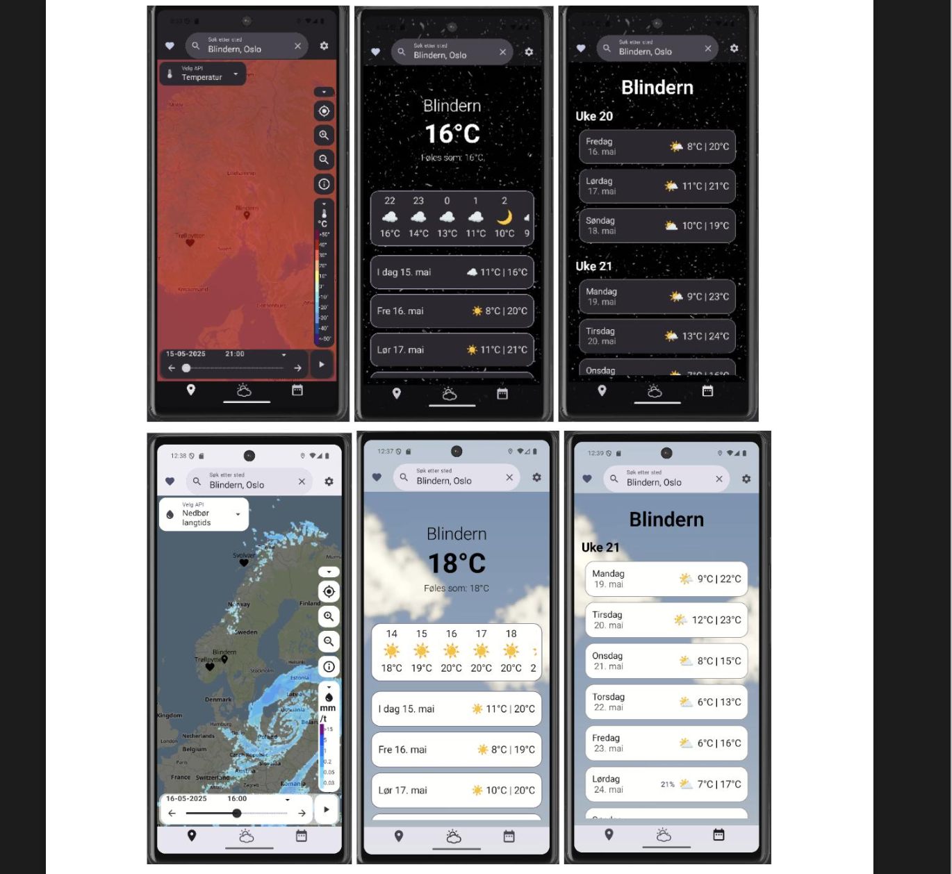
An interactive map-based Android app that overlays real-time weather data as visual tiles on a map of Norway. Users can:
- Navigate a live map rendered with MapLibre
- See weather conditions visualised directly on the map (precipitation, wind, temperature layers)
- Tap locations to get detailed weather forecasts
- Access alerts and meteorological data per region
Architecture
MVVM (Model-View-ViewModel) with coroutines for async data fetching:
Jetpack Compose UI
        ↓
   ViewModel + StateFlow
        ↓
    Repository
   ↙         ↘
Remote API   Local cache
Backend tile server
The map weather tile layer was served from a custom backend tile server that:
- Fetches raw meteorological data from Norwegian API sources
- Renders weather data as image tiles (PNG) in the XYZ tile format
- Serves tiles to the app’s MapLibre layer
This separation means the heavy processing (data fetching + rendering) happens server-side, and the app just receives ready-to-display tiles.
MapLibre integration
- MapLibre GL native for Android handles tile rendering and map interaction
- Custom tile source pointing to the backend tile server
- Layer management: toggling weather overlays on/off
- Tap event handling for location-specific queries
Data sources
- Norwegian Meteorological Institute API (MET/Yr.no) for forecasts
- Gridded data for tile rendering
- Location services for current position
Team & process
Team of 6, developed over one semester using GitHub with pull request reviews, feature branches, and sprint-based planning (Scrum-adjacent).
Recognition
Nominated among the 10 best projects in IN2000 for the semester.